When Bridges Killed Ferries
And how Queens was remade when fixed crossings replaced the water routes that once defined it
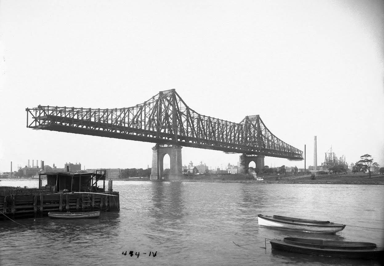
Queensboro Bridge under construction (1907), photographed from Astoria toward Roosevelt Island.
For centuries, ferries made New York possible. Then bridges and tunnels arrived promising permanence, speed, and scale. In Queens, that shift redrew neighborhoods, reordered commerce, and created the modern borough—while burying an older transit world beneath it.
The ferry has one flaw, if you are the sort of planner who likes straight lines and guaranteed schedules: it floats.
That is not a joke against ferries. It is the whole problem. Ferries depend on weather, docking conditions, marine maintenance, operating costs, tides, and the inconvenient habit of water to remain water. Bridges, by contrast, flatter the modern imagination. They are rigid, visible, and permanent. They persuade politicians that geography has finally been mastered.
And once New York fell in love with bridges and tunnels, ferries began to lose.
The Logic of Replacement
The history is not subtle. As the city expanded into the late nineteenth and early twentieth centuries, ferries that had once been indispensable became vulnerable the moment a fixed crossing offered similar access with greater capacity or prestige.
The municipal archives state this plainly. The Astoria Ferry operated between East 92nd Street and Astoria from 1920 to 1936, and was discontinued after the opening of the Triborough Bridge.[1] The Clason Point–College Point municipal ferry operated from 1921 to 1939.[2] This was not coincidence. It was policy by infrastructure. New routes were not merely added. Older systems were displaced.
When a bridge appears, it does not simply make travel easier. It changes land values, commuter behavior, freight patterns, and political assumptions about which places matter.
What Queens Gained
It would be silly to deny the gains. Bridges and tunnels helped turn Queens into something denser, more connected, and more urban than its earlier ferry-dependent geography would easily have allowed.
The Queensboro Bridge, opened in 1909, made direct large-scale movement possible between Manhattan and Long Island City. Rail tunnels under the East River, followed by subway expansion, made western Queens far more legible to residential development. The Triborough Bridge further integrated Astoria and surrounding districts into a metropolitan web of automobile and truck circulation. Later parkways and expressways extended that transformation outward, sometimes brutally.
This is the part of the story where triumph likes to congratulate itself. Access improved. Population grew. Industry scaled up. Land that had been peripheral became strategic. Long Island City emerged as a major transfer and industrial zone. Astoria densified. Ravenswood industrialized. Hunters Point became a rail-water-urban hinge of exceptional importance.
All true.
What Queens Lost
But what was lost?
First, a waterfront logic of neighborhood life. Ferry landings concentrate movement differently than bridges do. A ferry creates a node: a shoreline point where people gather, trade, wait, and disperse. Bridges and rail lines stretch that movement into corridors and systems whose benefits often pass through without stopping.
Second, certain local maritime economies. Once ferries declined, so too did parts of the small-scale service world around them: landing infrastructure, shoreline business culture, and the practical centrality of waterfront access for ordinary people.
Third, and this is more subtle, Queens lost a way of thinking about itself. The borough’s shorelines increasingly became industrial backlands, infrastructural margins, or real estate frontiers rather than common civic thresholds. Water shifted from being a practical route to either a problem or an amenity.
That is a major urban transformation disguised as engineering progress.
The Bridge Era and the Rise of the Interior
Once bridges, railroads, and subways took hold, the center of gravity shifted away from the landing and toward the station, the viaduct, the road grid, and eventually the highway interchange. Neighborhoods that were once important because they touched water could now be important because they touched a rail line.
That may sound obvious, but it has consequences.
It helps explain why some old waterfront communities stagnated while inland or rail-linked districts surged. It also explains why the shoreline of western Queens became so heavily industrial in the nineteenth and early twentieth centuries. Water remained useful, but increasingly for freight and factories, not as the main democratic route of daily human passage.
In other words, the water did not stop mattering. It changed jobs.
A Familiar New York Pattern
The municipal archives make a larger point here worth borrowing: ferry decline fits a broader New York pattern in which one generation’s indispensable infrastructure becomes another generation’s romantic residue.[3]
That happened in Queens repeatedly.
Working creeks became industrial sewers.
Ferry routes became obsolete after bridges.
Industrial shorelines later became redevelopment frontiers.
And now some of those same waterfronts are being rediscovered as residential and recreational assets, which is the sort of thing cities do when they have first exhausted and then sentimentalized a landscape.
The Irony of Modern Congestion
There is another irony, and it is not small. The same bridge-and-highway system that helped displace ferries also helped produce the congestion that has made ferries attractive again.
The Department of Records essay notes that the replacement of ferry routes with infrastructure “primarily designed for single, privately-owned car commuting” contributed to the gridlocked city we inherited.[4] That is a devastatingly polite sentence. What it means is: we built ourselves into traffic.
Queens knows this better than most places. Its twentieth-century transportation gains were real, but so were their side effects—pollution, congestion, shoreline severance, and unequal access. When people now talk about transit deserts, overloaded subway lines, and bus dependency, they are describing a city shaped by decisions that once treated fixed infrastructure as the final answer.
There is no final answer. Cities are too alive for that.
Conclusion
Bridges did not merely replace ferries. They rearranged Queens.
They enabled the borough’s rise as an urban-industrial-residential giant. They also demoted older waterfront systems and rewrote the meaning of access. The ferry age gave Queens one shape; the bridge-and-rail age gave it another.
The trick, for historians and planners alike, is to see that both shapes are still there.
End Notes
Images
Queensboro Bridge under construction (1907), photo by Eugene de Salignac, NYC Municipal Archives (public domain), Wikimedia Commons, “Blackwell's Island Bridge from Ravenswood shore,” https://commons.wikimedia.org/wiki/File:Blackwell%27s_Island_Bridge_from_Ravenswood_shore.jpg (accessed September 10, 2026).
Literary
[1] New York City Department of Records & Information Services, “The Rise, Fall, and Rise Again of the New York City Municipal Ferry System,” July 29, 2019, https://www.archives.nyc/blog/2019/7/29/ferries
[2] Ibid.
[3] Ibid.
[4] Ibid.
[5] Brete Murphy, articles on Long Island City, Astoria, Dutch Kills, Ravenswood, Hunter’s Point, and Steinway, bretemurphy.com