The Rockaways and the Politics of Partial Connection
Ferries, rail lines, bridges, storms, and the long history of getting to the edge of Queens
The Rockaways are often described as though they sit outside the ordinary life of New York City—far away, inconvenient, peripheral, reached only with planning and patience. That description contains some truth. But as history, it is too simple.
The deeper story of the Rockaways is not simple isolation. It is repeated connection, disconnection, and reconnection. Ferries, railroads, bridges, subways, and emergency transportation links have all, at different moments, promised to draw the peninsula more fully into the city. Yet each solution has also revealed the same stubborn fact: the Rockaways are connected to New York, but rarely on equal terms.
That pattern matters because transportation in the Rockaways has never been just about movement. It has shaped land value, recreation, class, public investment, and the meaning of belonging at the far edge of Queens.
The geography explains part of the problem. The Rockaway peninsula is long, narrow, exposed, and separated from much of Queens by Jamaica Bay. It belongs to the city, but it does not fit neatly into the city’s inland grid. Any route to the Rockaways has always had to confront water, distance, weather, and a limited number of practical approaches. In that sense, the peninsula is less a naturally isolated place than a place whose access has always depended on deliberate infrastructural and political choices.[1]
That distinction is important. A place can be physically near and still functionally distant. The Rockaways have often been exactly that: close on the map, harder in practice.
In the nineteenth century, the Rockaways were drawn into the region not only as a place to live, but as a place to visit. Rail connections were essential to that transformation. The Long Island Rail Road and affiliated lines helped turn the peninsula into a resort landscape, carrying visitors from Brooklyn, Manhattan, and elsewhere on Long Island to hotels, beaches, and recreational destinations.[2] The Rockaways, in other words, were not outside urban life. They were incorporated into it through leisure.
But leisure access and civic access are not the same thing.
One of the recurring themes in Rockaway history is that the peninsula was often connected for visitors before it was reliably connected for residents. Resort geographies can mask everyday transportation weakness. A city may build ways to bring people to a shoreline for pleasure without fully solving how year-round communities will move to work, school, hospitals, and the rest of urban life.
Water routes were part of this history too. In the early twentieth century, municipal ferry service helped connect Brooklyn to Jacob Riis Park in the Rockaways. The New York City Department of Records notes that the municipal Rockaway Ferry ran from Flatbush Avenue in Brooklyn to Jacob Riis Park between 1925 and 1937.[3] That route belonged to an older transportation logic, one in which ferries remained practical for reaching edge geographies and recreational sites not yet fully absorbed by fixed crossings.
Its disappearance tells us something important. Ferries did not fade because the water stopped mattering. They faded because planners and governments increasingly preferred fixed infrastructure—bridges, tunnels, rail lines—that promised permanence, larger capacity, and easier administrative control. When the Marine Parkway Bridge opened in 1937, the ferry route was discontinued.[4] The city had not stopped needing access to the Rockaways. It had simply chosen a different kind of access.
That choice had consequences.
Bridges make places newly legible. They change not just travel times but development patterns and public expectations. The Marine Parkway Bridge linked Brooklyn to the western Rockaways in a more fixed and automobile-oriented way, while the Cross Bay Bridge and Cross Bay Parkway provided another route across Jamaica Bay by way of Broad Channel.[5] Together, these crossings reduced dependence on ferries and made the peninsula more consistently reachable by road.
But road access, while important, did not erase the underlying complexity of the peninsula’s position. A place reached by a small number of corridors remains vulnerable to interruption. It also remains politically exposed. If service is poor, delayed, damaged, or underfunded, alternatives are limited.
Rail and rapid transit tell a similar story. The routes that eventually connected the Rockaways to the subway system began in private and regional railroad history before becoming part of the city transit network. What is now the IND Rockaway Line had been associated with Long Island Rail Road service before portions were acquired by New York City and rebuilt for subway use in the 1950s after severe storm damage and years of changing operational logic.[6] This conversion is often remembered as a major moment of integration. The Rockaways would be folded more fully into New York through the subway map.
And they were, to a degree.
Yet even the subway connection reflected partiality. The A train serves the peninsula, but not with the density, redundancy, or flexibility enjoyed by many other parts of the city. Long travel times remained part of Rockaway life. The route brought inclusion, but not parity. To gain subway service was not the same thing as becoming central.
This is where the phrase partial connection becomes useful. The Rockaways were never wholly cut off. But their links to the rest of the city have often been singular where others were multiple, fragile where others were redundant, seasonal where others were continuous, or politically visible only in moments of crisis.
No event made that clearer in recent memory than Hurricane Sandy.
When Sandy struck in 2012, the storm devastated the Rockaways and exposed the vulnerabilities of a coastal neighborhood dependent on limited infrastructure.[7] Housing was damaged, electrical systems were destroyed, transit service was interrupted, and the peninsula’s physical exposure became impossible to ignore. The disaster was environmental, but it was also infrastructural. It revealed what it means to live at the edge of a city that has never fully resolved how the edge should be supported.
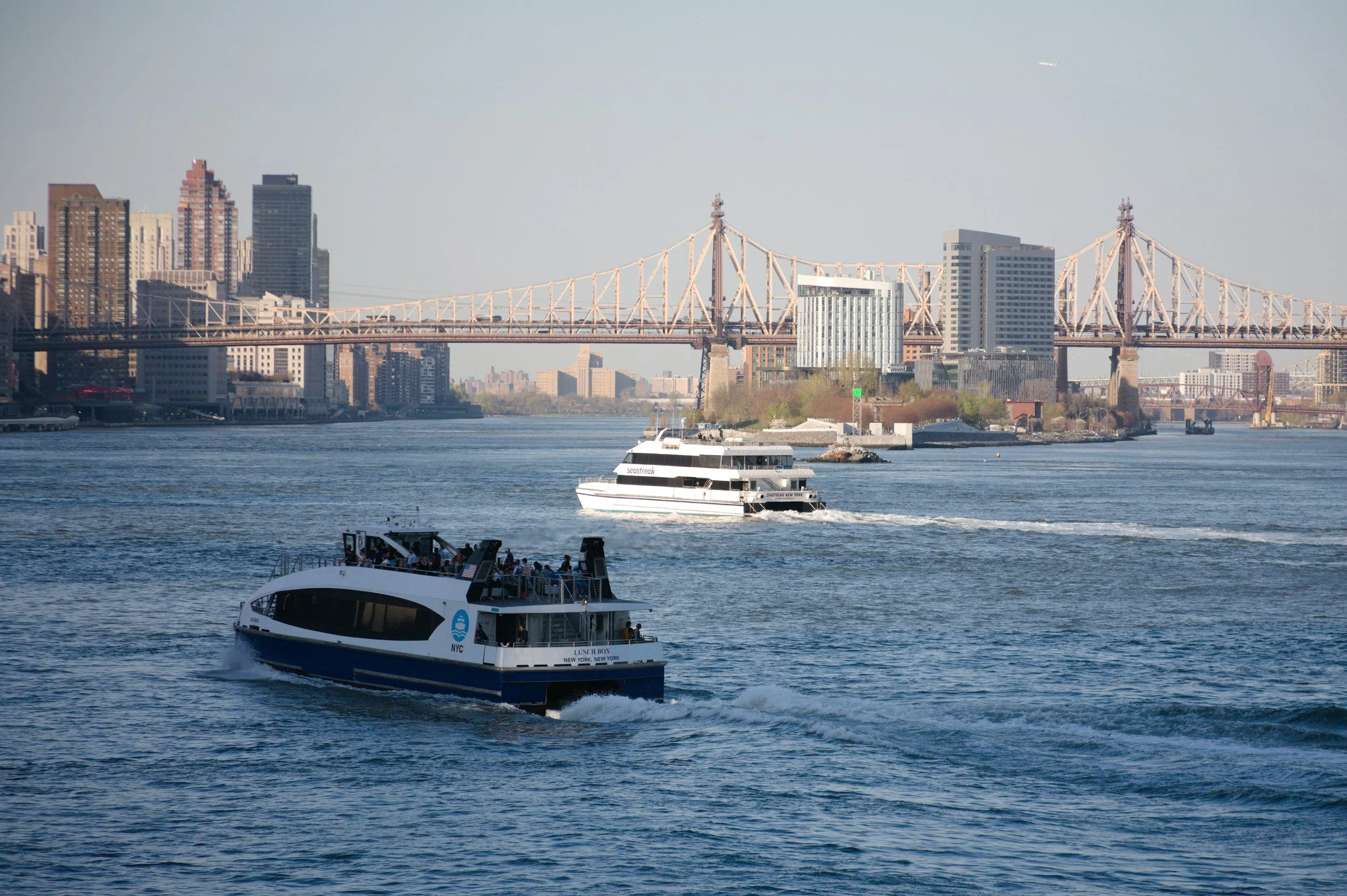
In the aftermath, ferry service returned in a new form. What began as a post-Sandy emergency transportation link eventually developed into a more regularized route and later became part of the city’s modern NYC Ferry system.[8] That revival is one of the most revealing episodes in recent Rockaway history because it demonstrates both the persistence of water transit and the limits of the city’s broader transportation framework. The ferry came back not as a nostalgic tribute to the past, but because the old geographic problem had never gone away.
The peninsula still needed another way out.
And yet the modern ferry, like many transportation solutions before it, has not solved the whole problem. Studies of NYC Ferry service have found meaningful commuter benefits, especially for riders positioned to access landings efficiently, but they have also shown that those benefits are unevenly distributed and often skew toward users with relative spatial and economic advantage.[9] In policy debates, the ferry has been praised for speed, comfort, and resilience while also criticized for high subsidy costs and selective service patterns.[10]
In the Rockaways, however, the story is somewhat more complicated than in luxury waterfront districts elsewhere. Here the ferry has carried not only the symbolism of redevelopment, but also the older meaning of compensatory connection. It serves a place long understood to be underserved by conventional transit logic. That does not make the service egalitarian by definition, but it does give it a different political and historical character than ferry routes primarily associated with waterfront branding in rapidly redeveloped neighborhoods.
This distinction matters because the Rockaways have occupied multiple roles in the city’s imagination at once. They have been resort, residential district, coastal frontier, recreation zone, working community, and site of vulnerability. Transportation to the peninsula has reflected those overlapping identities. Lines were built to bring bathers and tourists. Bridges supported motorists and beach traffic. Rail and subway links served commuters and residents. Emergency ferry service emerged when disaster revealed how exposed the area remained. None of these systems fully replaced the others in meaning. Each answered a different version of the same question: what is the Rockaways for, and for whom must it be made accessible?
That question is ultimately political.
To describe the Rockaways as isolated can unintentionally flatten their history. It suggests passivity, as though distance alone explains everything. But distance does not build or remove ferry routes. Distance does not choose whether service is seasonal, frequent, subsidized, redundant, neglected, or restored. Those are public choices. The transportation history of the Rockaways is therefore not just a record of engineering responses to difficult geography. It is a record of how the city repeatedly decided what degree of connection was sufficient for a place at its edge.
Sometimes that degree of connection was generous enough to encourage growth or tourism.
Sometimes it was just enough to maintain habitability.
Sometimes it failed visibly.
Sometimes it returned only after crisis.
That is why the history of transportation in the Rockaways should be understood not as a story of moving from isolation to integration, but as a story of uneven attachment. The peninsula has been pulled into the city repeatedly, but always through systems that leave its marginality partly intact.
The result is one of the most revealing landscapes in Queens.
The Rockaways show that connection is not a yes-or-no condition. A neighborhood can be in the city and still experience distance differently from the city’s core. It can be represented on the subway map and still feel remote. It can gain a ferry and still remain vulnerable. It can be celebrated as a public shoreline and still struggle for ordinary, durable transit justice.
Seen in that light, the Rockaways are not an exception to New York’s history. They are one of its clearest expressions.
They remind us that infrastructure is never only about mobility. It is also about priority. And in the Rockaways, priority has long arrived in pieces.
End Notes
[1] New York City Department of City Planning, “The Rockaways,” neighborhood and waterfront planning materials; see also Vincent F. Seyfried, The Long Island Rail Road: A Comprehensive History, part on the Rockaway branches.
[2] Vincent F. Seyfried and William Asadorian, Old Queens, N.Y., in Early Photographs (Mineola, NY: Dover Publications, 1991); Vincent F. Seyfried, The Long Island Rail Road: A Comprehensive History; and local historical materials on Rockaway resort development.
[3] New York City Department of Records & Information Services, “The Rise, Fall, and Rise Again of the New York City Municipal Ferry System,” July 29, 2019, https://www.archives.nyc/blog/2019/7/29/ferries.
[4] New York City Department of Records & Information Services, “The Rise, Fall, and Rise Again of the New York City Municipal Ferry System”; MTA Bridges and Tunnels historical materials on the Marine Parkway Bridge.
[5] MTA Bridges and Tunnels, historical overview materials for the Marine Parkway–Gil Hodges Memorial Bridge and Cross Bay Veterans Memorial Bridge.
[6] Metropolitan Transportation Authority, historical materials on the Rockaway Line; see also Brian J. Cudahy, Under the Sidewalks of New York: The Story of the Greatest Subway System in the World, revised edition.
[7] Federal Emergency Management Agency, Hurricane Sandy impact materials; New York City reports on Hurricane Sandy recovery in the Rockaways.
[8] New York City Economic Development Corporation, NYC Ferry system history and Rockaway route materials.
[9] Justin Tyndall, “Estimating Commuter Benefits of a New Transit System: Evidence from New York City’s Ferry Service,” June 10, 2025.
[10] Institute on Race, Power and Political Economy, “A Case Study of the NYC Ferry and Fair Fares,” 2024; Public Works Partners, city ferry planning and network analysis materials.